RACURS has signed a distribution agreement with Capella Space.
Новости
Statistics of Earth Remote Sensing Satellite Launches and Industry Trends in 2025
PHOTOMOD 8.1.5419 New version of the photogrammetric platform
PHOTOMOD 8.0.5081 New version of the photogrammetric platform
PHOTOMOD Radar 2.3.1. New version
RACURS is the winner of the BRICS Solutions Awards
PHOTOMOD 8.0 New version of the photogrammetric platform
PHOTOMOD 7.51 New version of the photogrammetric platform
PHOTOMOD 7.5 New version of the photogrammetric platform
PHOTOMOD 7.4 New version of the photogrammetric platform
The upgraded photogrammetric platform, PHOTOMOD 7.3, is now available: new functions and reliability
The new build of PHOTOMOD Radar 2.0.1 for SAR data processing is available
PHOTOMOD Radar software supports GaoFen-3 SAR images
The upgraded photogrammetric platform, PHOTOMOD 7.2, is now available: new functions and reliability
The Photogrammetric Platform Strategy Approach. GIM - Issue 7 - 2021.
RACURS has announced the PHOTOMOD purchase and upgrade special offer.
Our upgraded photogrammetric platform, PHOTOMOD 7.1, is now available: new functions and software
The new version PHOTOMOD Radar 2.0.1 for SAR data processing.
Date: 19 may 2021
Type of publication: news
 Since 2016, the American company Capella Space has been developing radar solutions, spacecraft and information service, provides on-demand very high-resolution (VHR) Synthetic Aperture Radar (SAR) Earth observation imagery. Through a constellation of small satellites, Capella plans providing easy access to frequent, timely and flexible information about the earth's surface required by specialists in dozens of industries worldwide.
Under the partner agreement, RACURS will distribute Capella’s data in Russia, Belorussia, Moldova, and Armenia.
By April 2021, the Capella constellation consists of three radar (SAR) microsatellites: Capella-2 (Sequoia), Capella 3 and Capella-4. Each satellite will carry an X-band, single-frequency radar capable of acquiring spotlight, sliding spotlight, and stripmap images. The main characteristics of the Capella SAR system are described in Table 1.
Table 1. Capella SAR system characteristics
|
Frequency Band |
X-band (9.4 – 9.9 GHz) |
|
Imaging Bandwidth |
Up to 500 MHz |
|
Imaging Modes |
Spotlight | Sliding Spotlight | Stripmap |
|
Imaging Polarizations |
Single-Pol HH |
|
Imaging Orbit Directions |
Ascending & Descending |
|
Imaging Look Directions |
Left & Right |
|
Imaging Latitude Ranges |
Capella-2 Satellite: -48.9°S to +48.9°N |
|
Look Angle Ranges |
25° - 40° (Standard Products) Up to 15° - 45° (Extended Products) Up to 5° - 45° (Custom Products) |
Capella's SAR satellites support a wide range of look angles and can collect data in different imaging modes. Imaging mode parameters and products specifications for SLC and GEO are in Table 2 and 3, respectively.
Table 2. Specification of the standard single look complex (SLC) image product type
|
Product |
Imaging Mode |
Nominal Scene Size |
Azimuth Resolution |
Slant Range Resolution |
Look Angle Range |
|
Spot SLC |
Spotlight |
5 km x 5 km |
0.5 m |
0.3 m |
25° to 40° |
|
Site SLC |
Sliding Spotlight |
5 km x 10 km |
1.0 m |
0.5 m |
25° to 40° |
|
Strip SLC |
Stripmap |
5 km x 20 km |
1.2 m |
0.75 m |
25° to 40° |
Table 3. Specification of the standard geocoded terrain corrected (GEO) image product type
|
Product |
Imaging Mode |
Nominal Scene Size |
# Of Looks |
Azimuth Resolution |
Ground Range Resolution |
Pixel Spacing |
Look Angle Range |
|
Spot GEO |
Spotlight |
5 km x 5 km |
9 |
0.5 m |
0.5 m to 0.7 m |
0.35 m |
25° to 40° |
|
Site GEO |
Sliding Spotlight |
5 km x 10 km |
5 |
1.0 m |
0.8 m to 1.2 m |
0.6 m |
25° to 40° |
|
Strip GEO |
Stripmap |
5 km x 20 km |
1 |
1.2 m |
1.1 m to 1.6 m |
0.8 m |
25° to 40° |
RACURS develops a software complex PHOTOMOD Radar for spaceborne SAR data processing. The software supports Capella Space images of SLC (Single Look Complex) and GEO (Geocoded Terrain Corrected) processing levels.
The process of importing Capella data from .JSON format into the internal PHOTOMOD Radar .rdp format:
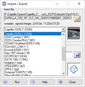
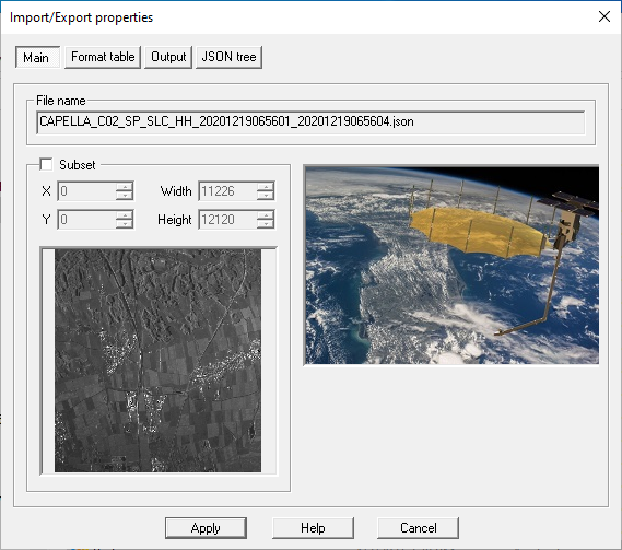
Fig.1 Dialog box for selecting the format and fragment of the image
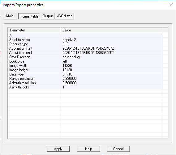
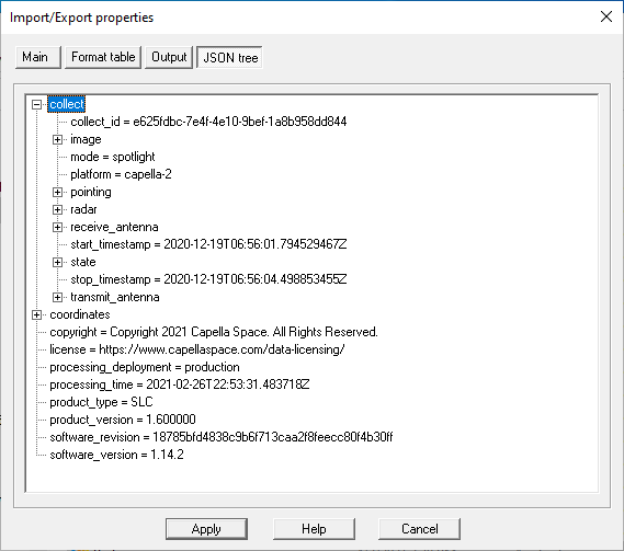
Fig.2. Information box and Capella images metadata
The geocoding process is designed to transform the image from the time-slant range radar coordinate system into the geographic coordinate system on the latitude-longitude grid of the WGS-84 ellipsoid.
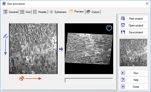
Fig 3. Displaying the geocoding processor
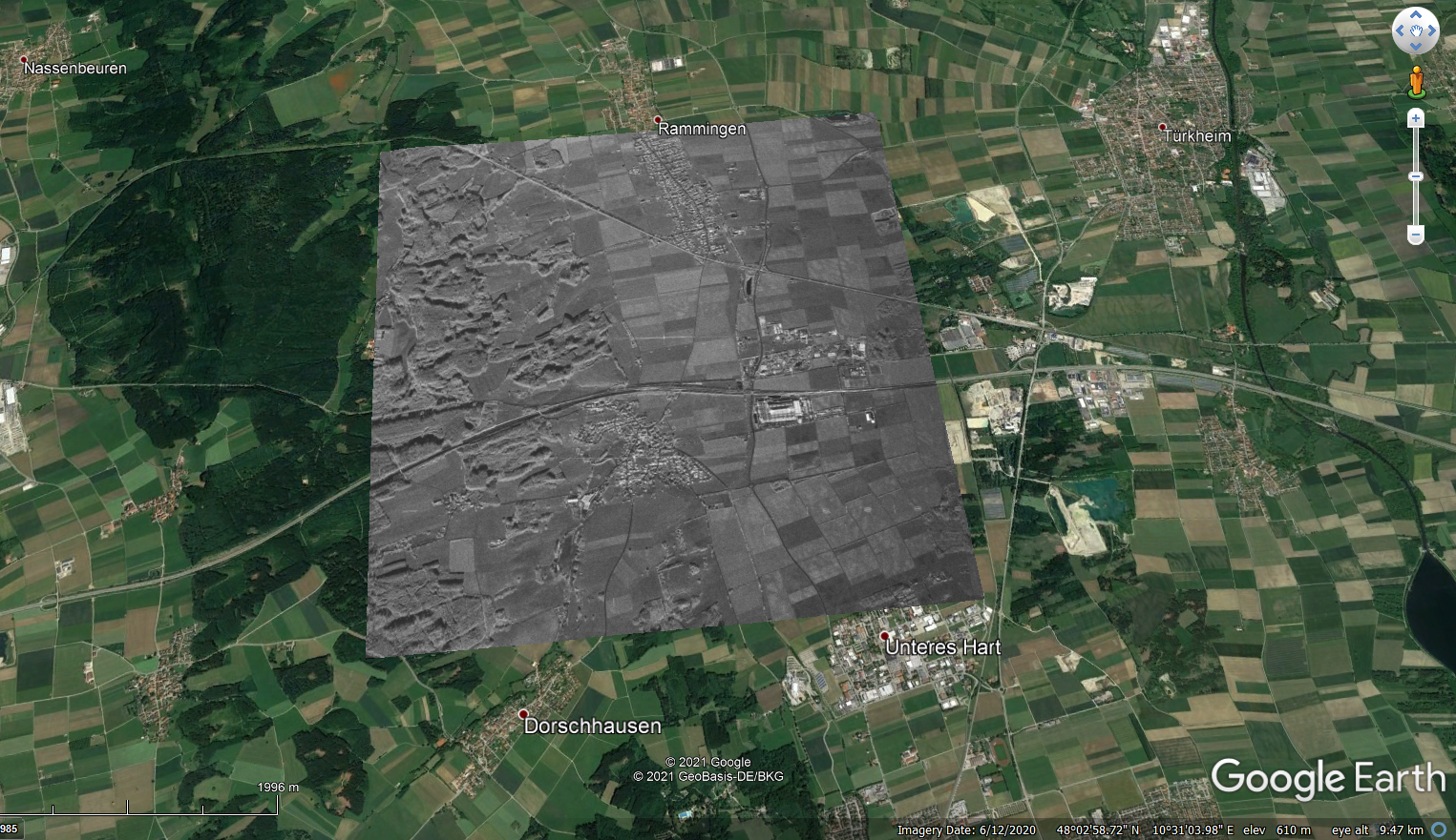
Fig 5. Displaying a fragment of a geocoded Capella image on a Google Earth background
As an example, we used a radar image from the Capella-2 (Sequoia) satellite from 01/29/2021 on the territory of Dallas County, Texas, USA. Processing level - SLC (single look complex), mode - Sliding Spotlight (resolution 0.5m in range, 1m in azimuth), polarization - HH.
You can request test data on the official website of Capella Space.
RACURS’s specialists evaluated the quality of Capella samples. The radiometric quality, resolution and metadata geocoding accuracy are shown on the screenshots below.
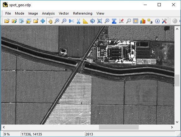
Fig 5. Radar image of Lakeview, California, USA
SAR on the Capella-2 (Sequoia) by Capella Space
SpotLight imaging mode, SpotGEO data format
Resolution 0.3 m in range, 0.6 m in azimuth
Visualization in PHOTOMOD Radar software
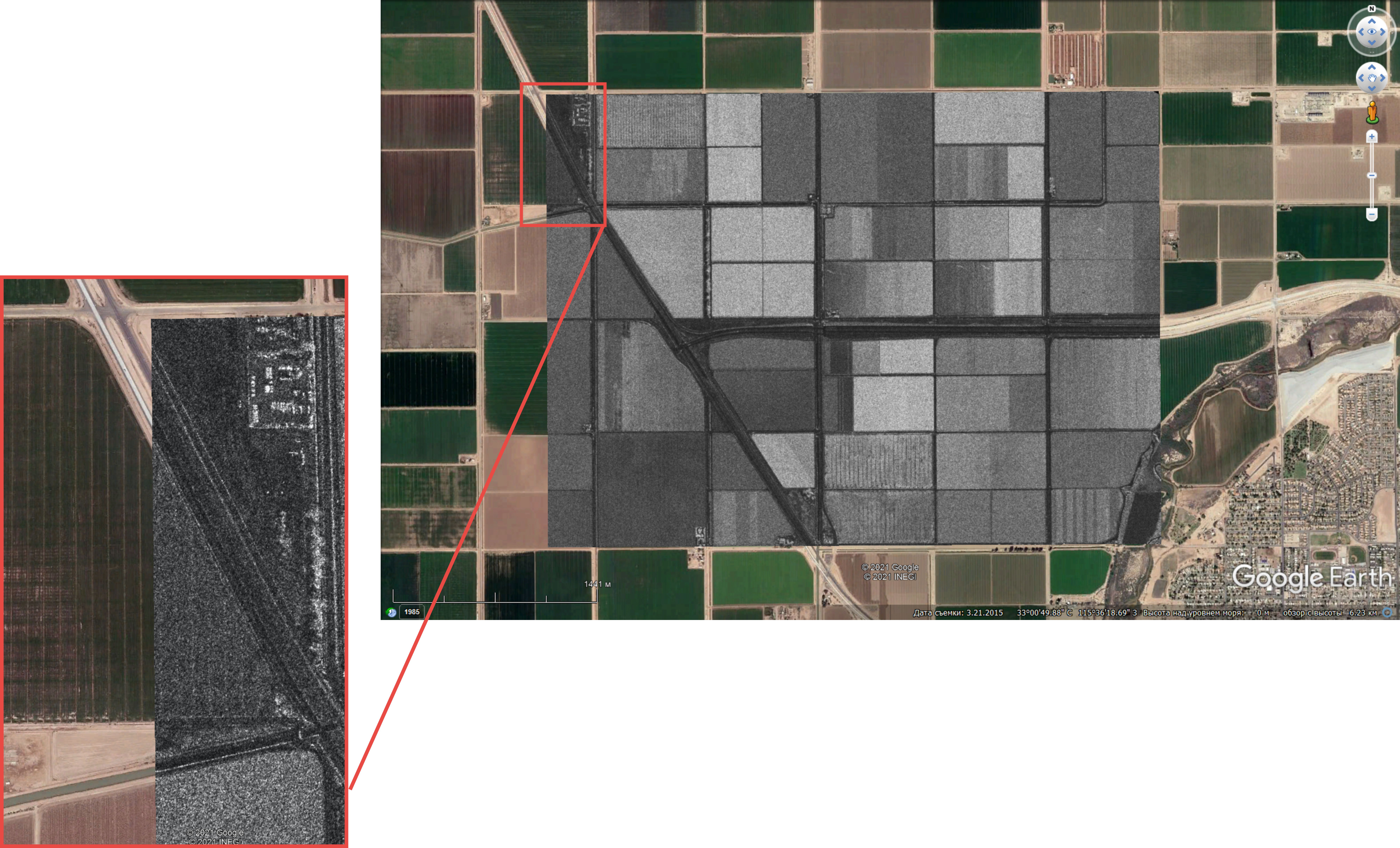
Fig 7. Radar image of Brawley, Imperial Country, California, USA. SAR on the Capella-2 (Sequoia) by Capella Space. Stripmap mode, SpotSLC data format. Resolution 0.8 m in range, 1.2 m in azimuth. Geocoded in PHOTOMOD Radar software, RACURS Group