


+7 (495) 720-51-27
com@racurs.ru
Сontact for technical issues:
dzz@racurs.ru
PHOTOMOD Radar
Software for processing spaceborne SAR data
Functionality
- Full-scale processing of Earth remote sensing data acquired by spaceborne synthetic aperture radars (SAR)
- Flexible modular architecture: you only buy what you need
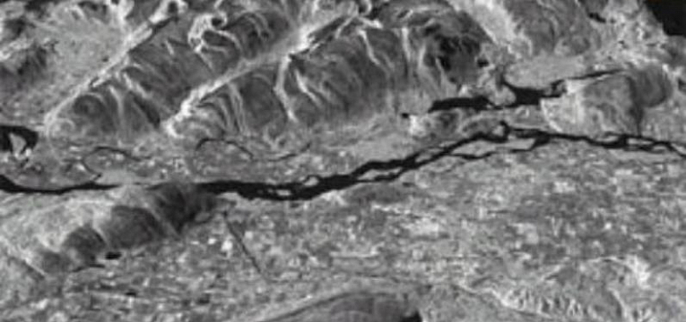
- Wide range of supported SAR sensors: Condor-KFA, TerraSAR-X, KOMPSAT-5, Sentinel-1, ICEYE, Capella , Gaofen-3, Chaohu-1, Fucheng-1, ERS-1/2, RADARSAT, ENVISAT, and others
- Ease of use: you are guided step-by-step through all stages of project processing
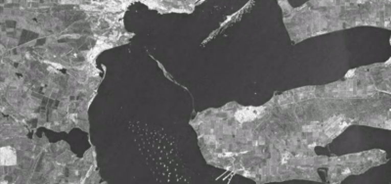
- A complete set of tools for obtaining high-level products: digital elevation models, digital models of displacements, orthomosaics, maps of surface classes and coherent detection of changes; ships and oil slicks detection
Support and training
- Easy to install and configure
- Easy to learn, user-friendly
- Qualified and prompt technical support
- Different levels of learning to work with the system
- Full technical documentation
- PHOTOMOD Radar Viewer
 is a free version of the PHOTOMOD Radar for viewing, importing and exporting SAR images

Configuration
Local version for full-scale data processing
Single module configuration: you only buy what you need
Cloud version. PHOTOMOD Radar is available in GeoCloud cloud-service
Formation results
If you select more than 1 license, the displayed price is NOT multiplied, because we have a system of discounts for every second, third, etc. When creating the Order, a field with the number of licenses should appear and the inscription: "The given price corresponds to the cost of one license, the calculation of the full cost of the order is made by the company's specialists according to the discounts: 2nd copy - 10%, 3 copy is 12.5%, 4th copy is 15%, 5th copy is 17.5%, 6th copy is 20%, more is available on request. "
There are no results, try to specify other input and output data.
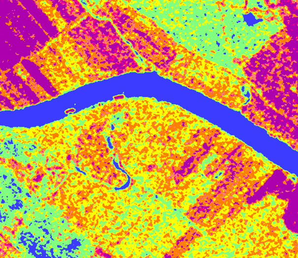 Image Enhancement
Speckle Noise Reduction, Wavelet Filtering, Apodization, Multi-Apodization
Features Extraction
Texture Analysis, Classification, Polarimetry, Edge Detection, Amplitude Changes
 Radargrammetry
Geocoding, RPC Geocoding, Stereo Processor, Metadata Editor
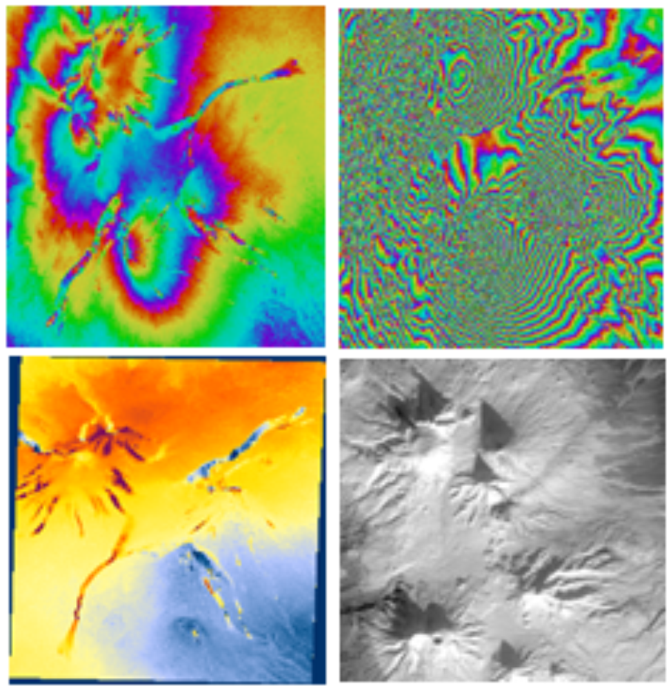
Interferometry
InSAR / DInSAR, InSAR Simulation, Coherent Change Detection, Coherent Coregistration
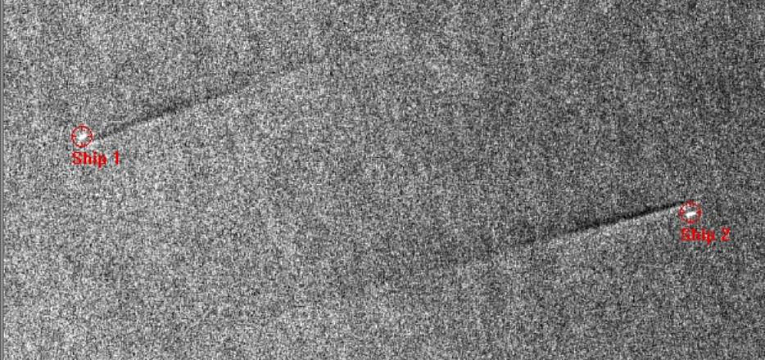
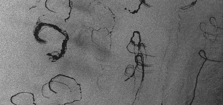
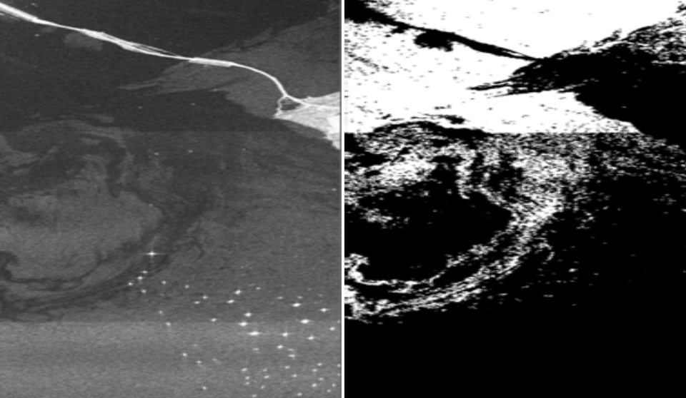 Marine Applications
Ship Detection, Oil Slicks Detection, Sea Waves Analysis
Georeferencing Utilities
Mosaicking, Geocoding Settings Adjustment, Basemap Downloading, Image Stacking

Neural Network Processing
Annotating, Training, Detecting, Patterns Maker, Patterns Recognition
| Operating systems |
Windows 7/8.1/10/11 x64 |
| CPU | Intel Core i/Xeon with a clock frequency 3,00 GHz and higher |
| RAM | 128 Gb (8 Gb per 1 core) |
| SSD/HDD |
4 Tb (SSD: min 500 Gb), including RAID-arrays and storage servers |
| Display | Professional stereomonitors like Planar, StereoPixel LcReflex |
| Grap |
Nvidia Tesla series and other CUDA-based adapters |
USB port should be available for hard lock key.
PHOTOMOD Radar Viewer is intended for viewing the Earth surface images, acquired by space synthetic aperture radar sensors Sentinel-1, KOMPSAT-5, ICEYE, Capella, TerraSAR-X, ERS-1/2, Radarsat, SIR-C/X, and others, as well as the raster images in formats USGS, GTOPO30, GeoTIFF, Tiff and BMP.
PHOTOMOD Radar Viewer supports the following functions:
-
Load images in two modes:
- with creating an additional file with hierarchic (pyramid) structure (it would take some time for file opening but further work with image will be more fast);
- without creating an additional file (file of any size is opened immediately, but while raster moving there is some data pumping from disk from time to time, and during scale change there is also some raster re-calculation, that could slow down the work significantly, especially with voluminous files); -
Image scrolling mode using keyboard and mouse;
-
Cursor positioning in the window using mouse and keyboard with indicating cursor coordinates and image pixels brightness;
-
Image zoom, set image to scale 1:1, "fit to window" scale;
-
Local image zoom-in using "digital magnifier";
-
Selection of image fragment of predefined configuration and opening it in new window or saving to file;
-
Compiling and visualization of selected fragments list;
-
Image rotation on defined angle (mirror horizontal and vertical rotation, rotation at 90, 180, 270 degrees or arbitrary angle) and change image scale along two axes;
-
System of hierarchical menus, dialogues, context help;
-
Brightness vertical and horizontal profiles creating;
-
Measuring distances between image points;
-
Brightness settings management, for example:
- creating, visualization and correction of image histogram;
- histogram type selection: equalized, logarithm, exponential;
- image brightness and contrast adjustment;
- selecting of histogram rejection modes at image loading;
- image palette change by selecting palette from list or creating new one by user; -
Overlaying raster image by geographic grid with scale setup by operator if the image header contains cartographic data;
-
Images printing with options of selection printed image area and its scale, as well as choosing printer and its settings;
-
Images opened in different windows could be tied using their file or geographic coordinates. Cursor in tied windows moves simultaneously. Images could be in different projections and coordinates will be re-calculated automatically "on the fly" using build-in "cartographic calculator";
-
Simultaneous loading and viewing of two images in vertical and horizontal locations, or as smoothly appearing layers one from under another;
-
Stereopairs preview in anaglyph mode, when one of the images is shown in red color range, and other - in green, and operator uses glasses with red and green filters;
-
Overlaying of raster image and vector image in Shape format. Shape format support provides visualization of the entire graphic and text information included to file, in modes similar to those developed in standard ESRI products.
-
Separate viewing of amplitude and phase of complex data.