About company
Our mission
Our history
- PHOTOMOD software is officially certified for compatibility with Astra Linux Special Edition, RED OS.
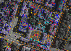
- PHOTOMOD 8.1: radical increase in the speed and reliability of space projects adjustment, adjustment of projects with ADS camera images, "free" model adjustment (without EO/GCP), object-oriented cut-line construction, video files processing, image replacement in GeoMosaic projects, PHOTOMOD storage analysis, support for the new versions of STILSAT and PhaseOne IIQ data.
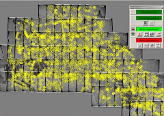
- 90 new PHOTOMOD licenses have been delivered to the PLC Roscadastre, and 50 workstations have been equipped with PHOTOMOD StereoMeasure in Roslesinforg.
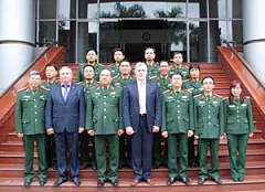
- PHOTOMOD in Uzbekistan: delivery of PHOTOMOD to the Republican Center AEROGEODEZIYA (Tashkent).
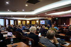
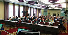
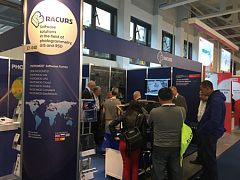
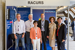
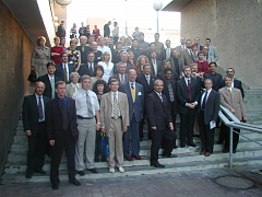
- Exhibitions and conferences: “Geodesy. Mine Survey. Aerial Survey. Navigation” (Russia), “GEOFORUM. Nizhny Novgorod. 2025” (Russia), “Spatial Data: MIIGAiK as Innovation Space” (Russia), “Interexpo GEO-Siberia 2025” (Russia), “The Century of Russian Photogrammetry” (Russia).
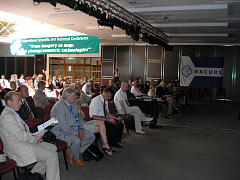
- XXIV International Scientific and Technical Conference “DIGITAL REALITY: Space & Geospatial Data, Processing Technologies”, September 22-25, 2025, Ekaterinburg, Russia.
-
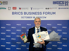
RACURS JSC became the winner of the BRICS Solutions Awards International Contest in the Sky, Space and Communication Technologies nomination category.
-
PHOTOMOD 8.0: DPW PHOTOMOD for the Astra Linux 1.7.x operating system; import/export of adjacent projects in Block Exchange XML format; compensation for the effect of Rolling Shutter; support of the new version of GaoFen-7, SuperView, STILSAT; LAS buildings and vegetation filter.
-
PHOTOMOD Radar 2.3: optimization of the toolset in the “Object Detection” module, the ability to refine geocoding parameters, and loading an optical raster-substrate onto the target area of interest from open remote sensing data.
-
New module PHOTOMOD Radar Neuro: search and classification of objects on SAR images using neural network and correlation technologies. Pretrained neural network weights available for TerraSAR-X, Gaofen-3, Kondor-FKA, Spacety, Umbra, Sentinel spaceborne SAR data.
-
Exhibitions and conferences: XVI International Research and Practice Conference “Geodesy. Mine Survey. Aerial Survey. Navigation” (Russia), Interexpo GEO-Siberia 2024 (Russia), the exhibition and forum “Spatial Data: MIIGAiK as Innovation Space” (Russia).
-
The organizing committee of Interexpo GEO-Siberia awarded RACURS JSC the 1st degree Diploma in the category “Import substitution: the best domestic specialized software”.
-
IV Joint International Scientific and Technical Conference “DIGITAL REALITY: Space & Geospatial Data, Processing Technologies”, September 16-19, 2024, Minsk, the Republic of Belarus.
-
Racurs celebrated its 30th anniversary.
-
PHOTOMOD 7.4: Linux version for PHOTOMOD UAS, effective use of graphics processing units (GPUs) to improve performance, expanded tools for editing and classifying point clouds, joint editing of vector objects by several operators.
-
PHOTOMOD 7.5: training and classification of point clouds using neural network algorithms, Zorkiy-2M space sensor support, automatic texturing of 3D vector models using images from the project.
-
PHOTOMOD in the Republic of Kyrgyzstan: the State Agency for Land Resources, Cadastre, Geodesy and Cartography was supplied with 6 PHOTOMOD licenses for processing satellite imagery, aerial photographs, and UAV data.
-
PHOTOMOD in education: in total, higher and secondary educational institutions in Russia and Belarus acquired 27 educational licenses.
-
123 PHOTOMOD licenses were delivered to 7 countries, and 408 workplaces were created.
-
Over 23 thousand square kilometers of ultra-high resolution optical data were delivered for mapping tasks.
-
The organizing committee of Interexpo GEO-Siberia awarded RACURS JSC the 1st degree Diploma in the category “Import substitution: the best domestic specialized software.”.
-
Exhibitions and conferences: “Earth and Space Technology for Knowledge of the Land” (Bangkok, Thailand), XIV International Research and Practice Conference “Geodesy. Mine Survey. Aerial Survey. Navigation” (Russia), Interexpo GEO-Siberia 2023 (Russia), Summer Space School - 2023 (Russia), IX All-Russian Congress of Cadastral Engineers (Russia), All-Russian Scientific and Practical Conference “Territory development management: strategy, tactics, regulation, reconfiguration” (Russia).
-
III Joint International Scientific and Technical Conference “DIGITAL REALITY: Space & Geospatial Data, Processing Technologies”, October 16-18, 2023, Sochi, Russia.

-
PHOTOMOD 7.3: Expanded possibilities for using LAS, NDVI calculation support, acceleration of 3D models building process.
-
Completion of the stereophotogrammetric complexes delivery for “Roskadastr” enterprises. It included 74 PHOTOMOD sets for stereo vectorization and 9 full sets of PHOTOMOD program.
-
Kazakh enterprises have expanded cartographic production by using PHOTOMOD tools.
-
More than 2 million sq. kms of radar survey data were delivered to our customers.
-
Exhibitions and conferences: Interexpo GEO-Siberia 2022 (Russia), XIII International Research and Practice Conference “Geodesy. Mine Survey. Aerial Survey. Navigation” (Russia).
-
II Joint International Scientific and Technical Conference “DIGITAL REALITY: Space & Geospatial Data, Processing Technologies”, September 12-15, 2022, St. Petersburg, Russia.
- Photogrammetric platform PHOTOMOD 7.1 and 7.2: new functional improvements. PHOTOMOD AutoUAS — new software for fully automatic processing of UAS images with the simplest interface. PHOTOMOD StereoClient —a new application for remote work in professional stereomode.
-
The new version PHOTOMOD Radar 2.0.1 for SAR data processing.
- Joint International Scientific and Technical Conference “DIGITAL REALITY: Space & Geospatial Data, Processing Technologies”, September, 6-9, 2021, Irkutsk, Russia.
-
Distribution agreement with Capella Space.
- More than 50 000 km² of satellite RSD were delivered to our customers.
-
PHOTOMOD 7.0: better performance and advanced functionality, new approach to photogrammetric processing of remote sensing data.
-
INTERGEO DIGITAL (Germany), 2nd International Conference “Geodesy, Cartography and Digital Reality” (Russia), Bronze sponsorship of the XXIV ISPRS Congress (posponed to 2021).
-
20th International Scientific and Technical Conference “FROM IMAGERY TO DIGITAL REALITY: ERS & Photogrammetry” is postponed to 2021.
-
More than 50 000 km² of satellite RSD were delivered to our customers.
-
PHOTOMOD 6.5: new algorithm for the bundle adjustment, new distributed processing implementation, radical quality improvements of the 3D modeling and visualization, new 3D-feature extraction tools.
-
National Geographic Information Institute granted PHOTOMOD to be an official Photogrammetric Suite in South Korea.
-
Exhibited: Interexpo GEO-Siberia 2019 (Russia), INTERGEO (Germany), 1st International Conference “Geodesy, Cartography and Digital Reality” (Russia).
-
19th International Scientific and Technical Conference “FROM IMAGERY TO DIGITAL REALITY: ERS & Photogrammetry”, October 28-31, 2019, Seoul, Republic of Korea.
-
Racurs: A Quarter of a Century in the Geoinformation Market. The Feodosy Nikolaevich Krasovsky Award for the best scientific and technical developments in geodesy and cartography
-
PHOTOMOD 6.4: Automatic generation of textured 3D-models (3D-TIN), radical speeding up of satellite blocks adjustment, easing of PHOTOMOD UAS restriction on input image size to 80 MP.
-
PHOTOMOD software is available at the cloud-based platform GeoCloud.work.
-
A distributor agreement with the Space Rocket Centre Progress.
-
Exhibited: Interexpo GEO-Siberia 2018 (Russia), Smart Geospatial Expo (Republic of Korea), INTERGEO (Germany), United Nations World Geospatial Information Congress (China).
-
18th International Scientific and Technical Conference “FROM IMAGERY TO DIGITAL REALITY: ERS & Photogrammetry”, September 24-27, 2018.
-
PHOTOMOD 6.3: fully automatic generation of True Ortho, more user-friendly PHOTOMOD UAS interface, increased reliability of UAS aerial triangulation.
-
PHOTOMOD distribution agreements with DIT Space SRL (Costa Rica) and TerraLink (Kazakhstan).
-
Exhibited: Geospatial World Forum (India), GEO-Siberia (Russia) INTERGEO (Germany).
-
17th International Scientific and Technical Conference “FROM IMAGERY TO DIGITAL REALITY: ERS & Photogrammetry”, October 16-19, 2017, Hadera, Israel.
-
SI Imaging Services and Racurs concluded an agreement on mutually beneficial promotion of KOMPSAT data and PHOTOMOD.
-
PHOTOMOD 6.1: dense DSM creation algorithm, StereoMeasure — forest valuation tools.
-
PHOTOMOD dealer agreement with TERRANALISIS LTDA (Chile).
-
Exhibited: GEO-Siberia (Russia), ASPRS (USA), ISPRS (Czech Republic), INTERGEO (Germany), Geomatics (Iran), Agrimensura (Cuba).
-
16th International Scientific and Technical Conference “FROM IMAGERY TO MAP: digital photogrammetric technologies”, November 14-17, Agra, India.
-
PHOTOMOD Lite 2016 Contest.
-
PHOTOMOD 6.0.2: new localization architecture including Chinese, English, Greek, Russian, Spanish languages.
-
PHOTOMOD distribution agreement with SI Imaging Services (Korea).
-
Exhibited: INTERGEO (Germany), GEO-Siberia (Russia), CUBA-2015 (Cuba), “Space Days in Kazakhstan” (Kazakhstan).
-
Organized: Regional seminar “Modern photogrammetric technologies. New possibilities of PHOTOMOD 6.0”, June 4, 2015,Astana, Kazakhstan. Russian-Vietnam seminar “Russian Technology of Remote Sensing Data Receiving and Processing”, December 7-9, 2015, Hanoi, Vietnam.
-
15th International Scientific and Technical Conference “From imagery to map: digital photogrammetric technologies”, October 26-29, 2015, Yucatan, Mexico.
-
Agreement with SI Imaging Services (Korea) on KOMPSAT-2,3,5 distribution in Russia, Belorussia and Kazakhstan.
-
PHOTOMOD 6.0: new possibilities, increase of RSD data processing volume and rate.
-
PHOTOMOD UAS — stand-alone full photogrammetric UAS-oriented software.
-
ISO 9000 certified.
-
Partnership agreement with National Company “Kazakhstan Gharysh Sapary”.
-
PHOTOMOD distribution agreement with OFEK Aerial Photography (Israel).
-
Exhibited: INTERGEO (Berlin, Germany), GEO-Siberia (Novosibirsk, Russia).
-
Organized: Third regional seminar: “3D-modeling. DPW PHOTOMOD” (Ekaterinburg, Russia), the regional seminar in Kazakhstan “Modern technologies of RSD processing. DPW PHOTOMOD”, 14th International Scientific and Technical Conference “From Imagery to Map: Digital Photogrammetric Technologies”, China.
-
PHOTOMOD education seminars were held in Greece, India, Russia.
-
Quantity of the orthomaps, 3D-models, DTMs were created by the Production Department.
-
Racurs Celebrates 20 Successful Years.
-
PHOTOMOD 5.24: ability to process SPOT 6 imagery, full localization in Chinese, new DEM edit toolbar, speeding up the new operations in distributed processing mode.
-
Agreements with: RAM Trade company (Kazakhstan), PHOTOMAP (Slovak).
-
GeoForm+ 2013, GeoSiberia 2013, Earth from Space, INTERGEO 2013, GEO-GIS Mongolia, Geomatics-2013 (GeoCuba), 13th International Scientific and Technical Conference “From imagery to map: digital photogrammetric technologies” (France).
-
PHOTOMOD education seminars were held in Greece, Turkey, China, France, Cuba, Russia.
-
Quantity of the orthomaps were created by the Production Department.
-
PHOTOMOD 5.2. New adjustment best for UAV, 3D models with textures in 3D-Mod module, new pushbroom scanner images adjustment.
-
Agreements with Galantis (USA), Navayuga Middle East FZC (UAE), Geomatica Ingenieria (Colombia).
-
Geoform+ 2011, GEO-Siberia — 2011, Earth from Space — the Most Effective Solutions, 11th International Scientific and Technical Conference "From imagery to map: digital photogrammetric technologies" (Spain).
-
New learning opportunities: webinars, video tutorials.
-
Quantity of orthomaps were created by Production Department.
- PHOTOMOD 5.1: GPGPU technology support, new algorithm of DTM building and filtering, lidar data converting to DEM of unlimited size.
-
Special PHOTOMOD HPC Edition for high-performance computing clusters.
-
PHOTOMOD Radar: new software tool of coherent co-registration of SAR images and coherent change detection, quality estimation software tools.
-
Agreement with Geosatelites, S.A. (Nicaragua).
-
INTERGEO EAST, Geoform+, GEO-Siberia, Map Asia, Xth International Scientific and Technical Conference “From imagery to map: digital photogrammetric technologies” (Gaeta, Italy).
-
4000 orthomaps were created by Production Department.

- PHOTOMOD 5.0. New level of automation and productivity.
-
Agreements with Alezi Teodolini (Brazil), Media Data Communication (Indonesia), GEOINFO SERVICES (Malaysia), CIS GmbH (Germany).
-
GeoEye´s Most Innovative International Channel/Reseller.
-
PHOTOMOD has been certified for using in Russian Ministry of Defence.
-
Geoform+ 2009, GEO-Siberia — 2009, IVth International Conference "Earth from Space - the Most Effective Solutions", 2nd IXth International Scientific and Technical Conference "From imagery to map: digital photogrammetric technologies" (Attica, Greece).
-
Quantity of orthomaps were created by Production Department.
-
PHOTOMOD 4.4: new GCP Survey module, 3D objects while exporting to AutoCAD, direct input of GPS data, distributed processing.
-
PHOTOMOD Radar: new Ship detection, Sea-Waves analysis modules, Polarimetric processor.
-
Agreements with Sistemi Avanzati srl (Italy) and SIGMAGEO (Portugal)
-
ISPRS, INTERGEO EAST, Geoform+ 2008, GEO-Siberia, VIIIth International Scientific and Technical Conference "From imagery to map: digital photogrammetric technologies" (Porec, Croatia).
-
4000 orthomaps were created by Production Department. 3D modeling of cities.
PHOTOMOD 4.3: block layout by projection centers only, bundle adjustment, TIN simplifying with user-defined level of accuracy.
PHOTOMOD 4.2: radiometric correction of images, support of hand wheels/foot pedals for stereo vectorization, pan-sharpening.
PHOTOMOD Radar 4.2: image processing tools, oil spill detection processor.
Geomatica-2007, INTERGEO EAST, Geoform+ 2007, GEO-Siberia — 2007, VIIth International Scientific and Technical Conference "From imagery to map: digital photogrammetric technologies" (Nessebar, Bulgaria).
Racurs has been awarded the Big Gold Medal of Siberian Fair in the frame of GEO-Siberia — 2007.

-
PHOTOMOD 4.1: "monoblock" and "stereoblock" processing for all supported scanner sensors.
-
PHOTOMOD 4.0: fully automated tie points measurement, RPC-stereoblock processing.
-
Agreement with GIS Sofia (Bulgaria), "Uralgeoinform" (Russia).
-
INTERGEO EAST, Geoform+ 2006, GEO-Siberia — 2006, VI International PHOTOMOD User Conference (Budva, Becici).
-
Racurs has been awarded the Big Gold Medal of Siberian Fair in the frame of GEO-Siberia — 2006.
-
PHOTOMOD 3.8.: working with georeferenced raster maps in AT and StereoDraw modules.
PHOTOMOD GeoMosaic: georeferencing and mosaicking raster images from a number of external formats independently of the PHOTOMOD system. -
License agreement with ORBIMAGE, Inc.
-
Racurs won the World Bank's tender to supply forestry enterprises with software tools.
-
V International PHOTOMOD User Conference (Jurmala).
-
PHOTOMOD 3.6. New modules: PHOTOMOD StereoLink (stereo feature extraction within Microstation environment) and PHOTOMOD Radar (SAR data processing).
PHOTOMOD 3.7: epipolar transformation “on-the-fly”, QuickBird and IKONOS mono blocks processing, SPOT 5 imagery processing (HRG and HRS sensors). -
XXth ISPRS Congress in Istanbul, IV International PHOTOMOD User Conference (Minsk).
-
Agreement with the Czech company GEODIS Brno, certification of PHOTOMOD Ver.3.6 by Space Imaging
-
PHOTOMOD 3.5. ASTER, IKONOS, QuickBird images processing.
-
Delivery of 28 sets of PHOTOMOD within a tender in lot 5-C of LARIS project of International Bank for Reconstruction and Development for Russian Federal Land Survey Cadastre centers in Irkutsk and Saratov.
-
Racurs was licenced by the Federal service of geodesy and cartography of Russia to cartographical production.
-
The IIIrd International PHOTOMOD User Conference (Golitsino). Celebration of Racurs 10 years jubilee.
-
PHOTOMOD 3.11. Automatic interior orientation in AT module. Introduction of Mosaic module.
-
The IInd International PHOTOMOD User Conference (St. Petersburg).
-
Production project: aerial survey data processing of electric power lines (about 6000 images).
-
PHOTOMOD 3.0. Network technology, scanner space imagery processing.
-
The Ist International PHOTOMOD User Conference (Irkutsk).
-
Production Department formation, realization of first photogrammetric processing projects.
-
Stereo feature extraction with code table.
-
Entrance into ISPRS as a sustaining member.

-
PHOTOMOD StereoDraw. 3D vectorization in stereo.
-
First agreements with foreign dealers.
-
PHOTOMOD DTM (DTM creation and editing, contour lines generation, orthorectification).
-
PHOTOMOD VectOr (object drawing and editing on orthophoto).
-
Entrance into GIS Market Support Association of Russia.

- The first commercially available version of PHOTOMOD. Single stereopair orientation, stereo visualization, matching.
- Racurs company foundation.


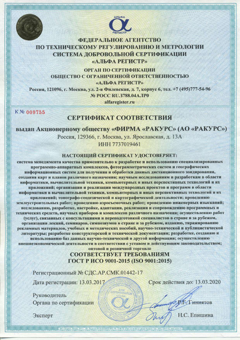
Licenses and certificates


Partners