The newest version: 8.0.4705 ×64
PHOTOMOD GeoMosaic

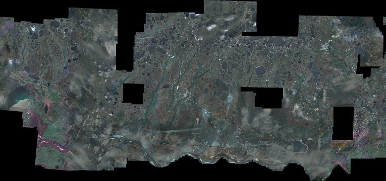
- Creating high-precision mosaics from any number of orthorectified images (tens of thousands source images can be processed)
- Building precise mosaics from georeferenced images of various formats
- Image processing: Radiometric image enhancements (filters, color/brightness/contrast balancing, histogram adjustment, etc.); Pan-Sharpening; DustCorrect
- Fully automatic seam line creation
- Automatic tiling
- Flexible distributed processing for effective utilization of all available computing capacities (multicore processors, multi-processor systems, network functionality), maximizing operating speed.
- On-the-fly preview of final mosaic (immediately reflecting changes in seam-lines, tie points and brightness adjustment) to control quality of the output product in real time.
- High productive capacity and efficiency: use of the distributed processing technologies and support of high-efficiency computing capacities increases workflow efficiency
- High quality guaranteed by use of sophisticated image processing algorithms
- Scalability: unlimited sized rasters and blocks of tens thousands images are supported
- Profitability: low expense — high-quality of digital image mosaic production
- Actuality: software development using the latest technologies
- Easy to use software: user friendly interface — no extensive training required
- Effective technical support: support and accompany customers step by step
- Flexibility: easy integration with any third party workflow

Formation results
Georeferencing of raster images
PHOTOMOD GeoMosaic is intended for working with various types of georeferenced digital images, including aerial and space imagery as well as digitized raster maps. You can make georeferencing of raster images, using productivity tools of PHOTOMOD GeoMosaic.
Creating high-precision mosaics
Creating high-precision mosaics from any number of orthorectified images (tens of thousands source images can be processed).
Image processing
Radiometric image enhancements (filters, color/brightness/contrast balancing, histogram adjustment, etc.). Pan-Sharpening. DustCorrect.
Seam line creation
Fully automatic and manual seam line creation algorithm respecting object outlines and image discontinuities for the highest quality of target mosaic.
Automatic tiling of the mosaic
Single sheet creation (sheet border can be defined by user as well as it can be like imagery block outline). Automatic slicing into sheets using image outlines. Automatic slicing mosaic into user defined sheets.


