PHOTOMOD software is available at the cloud-based platform GeoCloud.work.
More news on this topic
PHOTOMOD 8.0.5081 New version of the photogrammetric platform
PHOTOMOD Radar 2.3.1. New version
RACURS is the winner of the BRICS Solutions Awards
PHOTOMOD 8.0 New version of the photogrammetric platform
PHOTOMOD 7.51 New version of the photogrammetric platform
PHOTOMOD 7.5 New version of the photogrammetric platform
PHOTOMOD 7.4 New version of the photogrammetric platform
The upgraded photogrammetric platform, PHOTOMOD 7.3, is now available: new functions and reliability
The new build of PHOTOMOD Radar 2.0.1 for SAR data processing is available
PHOTOMOD Radar software supports GaoFen-3 SAR images
The upgraded photogrammetric platform, PHOTOMOD 7.2, is now available: new functions and reliability
The Photogrammetric Platform Strategy Approach. GIM - Issue 7 - 2021.
RACURS has announced the PHOTOMOD purchase and upgrade special offer.
Our upgraded photogrammetric platform, PHOTOMOD 7.1, is now available: new functions and software
The new version PHOTOMOD Radar 2.0.1 for SAR data processing.
RACURS has signed a distribution agreement with Capella Space.
Date: 16 july 2018
Type of publication: news
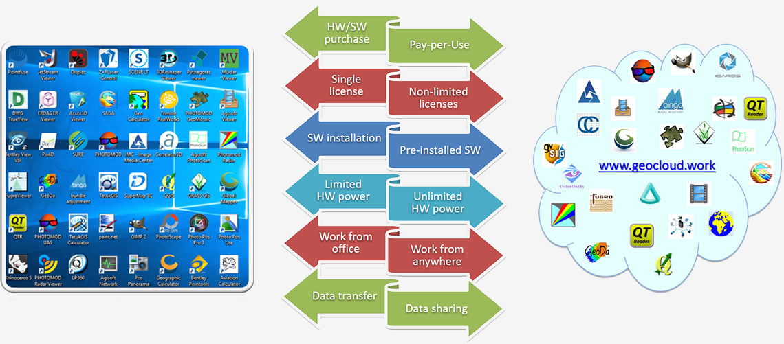
 GeoCloud.work is a powerful cloud-based platform for geospatial software and data. It works for geospatial professionals, software vendors and geospatial data providers.
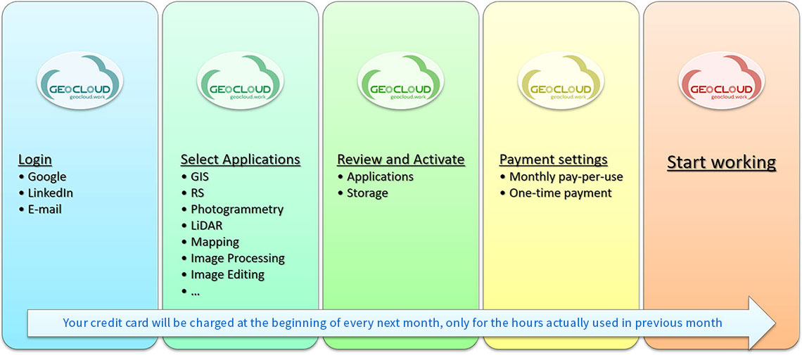
GeoCloud.work provides easy access to 30 software packages, pay-per-use model for working with worldwide software and a powerful and scalable worldwide cloud based computer infrastructure for mapping organizations.
-
Advantages:
- A unified and convenient approach to different geoinformation software and data
- A direct approach to free and pay-per-use GeoData
- Scalable and always available computer environment — computers, storage, web
- Pay-per-use model for working with worldwide software and data
- Technology-based protection against software piracy
- A meeting point for collaboration between geoinformation software developers, data providers and mapping organizations worldwide
- DPW PHOTOMOD, PHOTOMOD UAS, PHOTOMOD GeoMosaic, PHOTOMOD Radar, PHOTOMOD Radar Viewer, PHOTOMOD Lite, and PHOTOMOD GeoCalculator at the one platform


