


Complete Digital Photogrammetric Workstation.
The NEWEST version: 8.1.5504 x64 (Download).
JSC «RACURS»: Software solutions in the field of photogrammetry, GIS and remote sensing
- More than 30 years of successful operation in the global geoinformatics market.
- Development and support of software for digital photogrammetric and radargrammetric data processing of spaceborne, airborne, and unmanned surveys under the trademark PHOTOMOD™.
- Supply of remote sensing data and execution of production-scale processing of remote sensing data of any volume.
- Conduct of research and development work in the field of remote sensing data processing.
- Status as an IT company since 2014.
- Status as a Small technological company since 2023.
- PHOTOMOD is the most widely adopted commercial photogrammetric system in Russia.
- Over 1, 200 user companies (>12, 000 workstations) in 80+ countries worldwide.
- PHOTOMOD serves as the foundational photogrammetric system employed by the State Space Corporation ROSCOSMOS, PLC ROSCADASTR, Federal Forestry Agency, as well as research and commercial entities.
- Numerous awards from international and Russian exhibitions and partner companies.
- Winner of the International BRICS Solutions Awards competition in the category «Sky, Space and Communication Technologies».
Events
Services

We are armed with sufficient technical and human resources to implement projects of practically any size and complexity.
- Quality control at all technological stages.
- Speed and quality of work.
- Individual approach to each project.

Racurs Company is experienced in scientific and development in the field of photogrammetry and remote sensing.
- Algorithms and methods development.
- Remote sensing data testing.
- Development of one-purpose solutions.
Technology
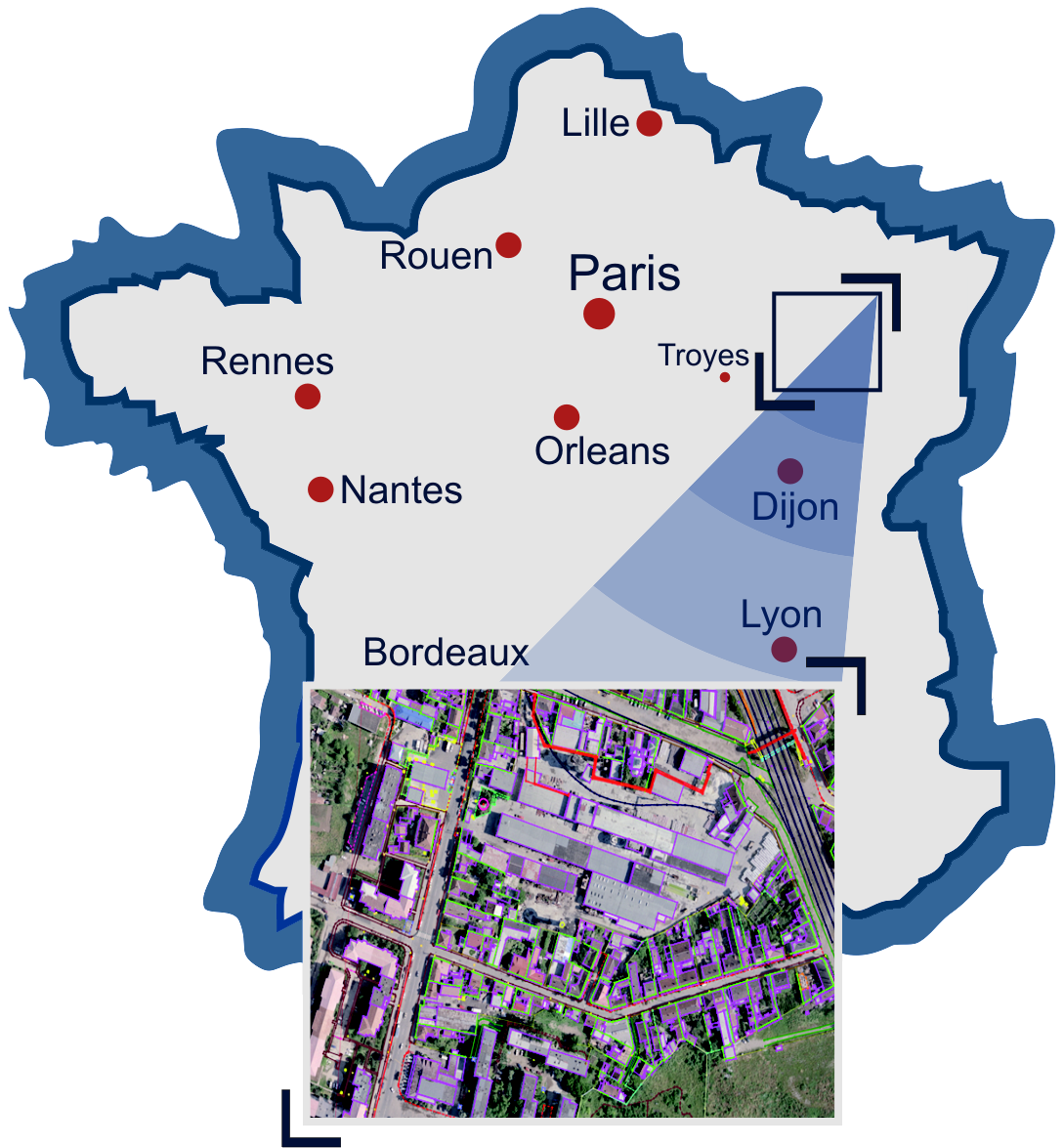
Target is creation of a topographic data base on the territory of France.
#topographic_base
#stereovectorisation
#topographic_base
#stereovectorisation
Used software:
Results:
- 4.5% of the France’s territory.
- Code table including 133 codes.
- Required accuracy: 1 m (for 3D vectorization).
- Altogether over 40 operators were trained and engaged in the project.
Subscribe to our email newsletter to receive updates