


GaoFen-3 SAR data processing in PHOTOMOD Radar
Section: satellite data processing
Author: RSD Group
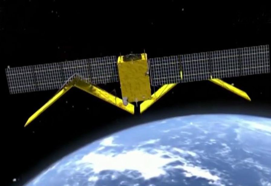 On August 10, 2016, the China National Space Administration (CNSA) and Chinese Academy of Space Technology (CAST) launched GaoFen-3, a high-resolution SAR satellite with 12 imaging modes in C-band. The second satellite of the series was launched on November 22, 2021
The main fields of application are meteorology, protection of water resources, monitoring of natural disasters, land and ocean. The main characteristics of the GaoFen-3 system are described in Table 1.
Table 1. GaoFen-3 system characteristics
|
Central frequency |
C band/5.4GHz |
|
Signal bandwidth |
0 - 240 MHz |
|
Orbit, altitude |
Sun-synchronous orbit, 755km |
|
Imaging Mode |
Sliding Spotlight | Ultra-Fine Strip | Fine Strip 1&2| Standart Strip| Narrow/Wide/ Global ScanSAR | Quarter-Polarization Strip1&2| Wave| Extended |
|
Polarization |
Single/Dual/Quar-polarization |
|
Incidence angle |
10° - 60° |
|
Spacecraft mass |
2779 kg |
|
Antenna size |
15 m x 1.5 m |
The GaoFen-3 satellite supports a wide range of look angles and can collect data in 12 different imaging modes. All these 12 imaging modes are actually fallen into 5 categories in terms of SAR working mechanism, which namely are Spotlight (SL), Strip-Map (FSI,FSII,SS,QPSI,QPSII,EXT), dual-channel DPCA (UFS), Scan-SAR (NSC, WSC) and Wave-mode (WAV). Imaging mode parameters and products specifications are in Table 2.
Table 2. Specification of the GF-3 SAR imaging mode
|
Beam Mode |
Incidence Angle |
Number of looks A×E |
Nominal resolution (m) |
Swath(km) |
Polarization |
|
|
Sliding Spotlight (SL) |
20° - 50° |
1×1 |
1 |
10×10 |
HH or VV |
|
|
Ultra-Fine Strip (UFS) |
20° - 50° |
1×1 |
3 |
30 |
HH or VV |
|
|
Fine Strip1 (FSI) |
19° - 50° |
1×1 |
5 |
50 |
HH+HV or VV+VH |
|
|
Fine Strip2 (FSII) |
19° - 50° |
1×2 |
10 |
100 |
HH+HV or VV+VH |
|
|
Standard Strip (SS) |
17° - 50° |
3×2 |
25 |
130 |
HH+HV or VV+VH |
|
|
Narrow ScanSAR (NSC) |
17° - 50° |
1×6 |
50 |
300 |
HH+HV or VV+VH |
|
|
Wide ScanSAR (WSC) |
17° - 50° |
1×8 |
100 |
500 |
HH+HV or VV+VH |
|
|
Global ScanSAR (GLO) |
17° - 53° |
2×(2~4) |
500 |
650 |
HH+HV or VV+VH |
|
|
Quarter-Polarization Strip1 (QPSI) |
20° - 41° |
1×1 |
8 |
30 |
HH+HV+VV+VH |
|
|
Quarter-Polarization Strip2 (QPSII) |
20° - 38° |
3×2 |
25 |
40 |
HH+HV+VV+VH |
|
|
Wave (WAV) |
20° - 41° |
1×2 |
10 |
5×5 |
HH+HV+VV+VH |
|
|
Extended (EXT) |
Extended Low |
10° - 20° |
3×2 |
25 |
130 |
HH+HV or VV+VH |
|
Extended High |
50° - 60° |
3×2 |
25 |
80 |
HH+HV или VV+VH |
|
The PHOTOMOD Radar software is intended for full-scale processing of Earth remote sensing data acquired by spaceborne radars with synthesized antenna aperture (SAR) such as KOMPSAT-5, Sentinel, ERS-1/2, Radarsat, SIR-C/X, ENVISAT ASAR, TerraSAR-X, ALOS, COSMO-SkyMed, etc., and generation secondary information products
The process of importing GaoFen-3 data from .XML format into the internal PHOTOMOD Radar .rdp format:
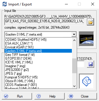
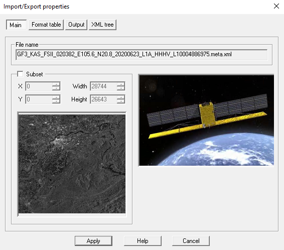
Fig.1 Dialog box for selecting the format and fragment of the image
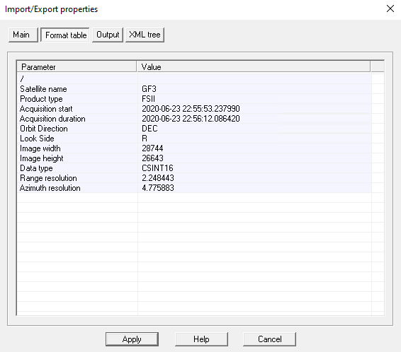
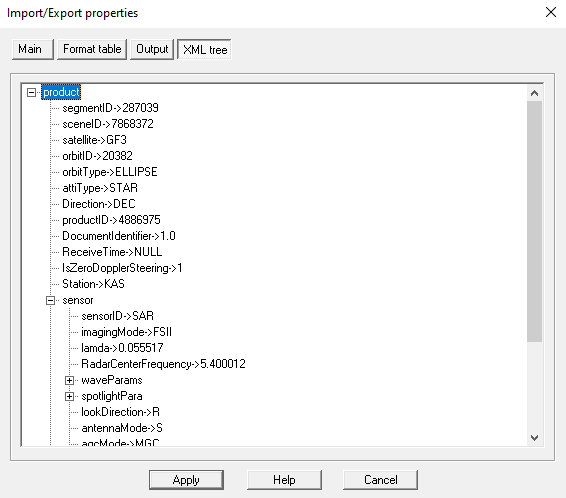
Fig.2. Information box and GaoFen-3 images metadata

Fig.3. Process of exporting GaoFen-3 data to RDP format
The geocoding process is designed to transform the image from the time-slant range radar coordinate system into the geographic coordinate system on the latitude-longitude grid of the WGS-84 ellipsoid.
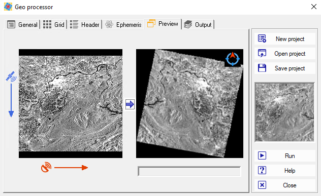
Fig 4. Displaying the geocoding processor
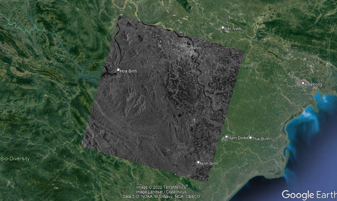
Fig 5. Displaying a fragment of a geocoded GaoFen-3 image on a Google Earth basemap
As an example, we used the radar image from 01/29/2021 on the territory near the city of Hanoi, Vietnam. Processing level - SLC (single look complex), mode - Fine Strip2 (Wide stripmap) resolution 10m, polarization - HH.
Information materials can be requested on the official website of Head Aerospace Group. Test data is available upon request. The official website of the company https://www.head-aerospace.eu/.
The RACURS company is the official partner of Head Aerospace Group.