
Racurs Company participated in the United Nations World Geospatial Information Congress, November 2018, Deqing, China.
More news on this topic
XXIV ISPRS Online Congress, June 6-11, 2022
2nd International Scientific and Practical Conference “Geodesy, Cartography and Digital Reality”
We are delighted to announce our Bronze sponsorship of the XXIV ISPRS Congress!
Remote Sensing journal supports the conference as a media partner.
INTERGEO-2018: the same subject, the different event every year.
Come meet us at INTERGEO and get a special discount on PHOTOMOD and RSD!
“Interexpo GEO-Siberia 2018”: positive trends.
New version of PHOTOMOD was presented at the Geospatial World Forum in India
Date: 5 december 2018
Type of publication: exhibitions and seminars
 A few years ago the government of China decided to make Deqing a capital of geoinformation technologies and approached the issue with a truly Chinese scale. In the shortest time possible, just in 2 years, the modern congress center and two exhibition halls were built, city infrastructure was modernized. All this shows the great importance of geoinformation for Chinese authorities.
Initiated by the United Nations Committee of Experts on Global Geospatial Information Management (UN-GGIM), a subsidiary body of United Nations Economic and Social Council (ECOSOC) that is mandated to convene global forums to promote comprehensive dialogue on global geospatial information management with all governments, non-governmental organizations, academic and research institutions, and the private sector, the Congress will be organized by the United Nations through Statistics Division as the UN-GGIM Secretariat, in collaboration with the Government of China through the Ministry of Natural Resources and the Government of Zhejiang Province of China.
 The Congress is aimed to provide a convening, participatory and inclusive environment to enhance the communication, understanding, knowledge and application of geospatial information management to address local, regional and global challenges, and to enable UN-GGIM to better understand and address the development of geospatial information management of Member States, mobilize willingness and resources to improve geospatially enabled governance of Member States, enhance the best and highest application of geospatial information for evidenced based policy making and citizen-centric services in Member States, enhance the regional and global geospatial information sharing systems, and crucially, support geospatially enabled sustainable development that leaves no one behind.
The support of the Chinese government helped to gather more than ten thousand participants of the congress from hundreds of countries. The fact, that about 3 million US Dollars were spent on transport service for the guests with ultramodern electro cars and electro buses and the facial recognition system was used for participants’ identification, talks about the scope and level of the Congress organization.
The program of the Congress consisted of plenary and breakout sections as well as the exhibition, in which 100 companies exhibitors participated, including such well known companies as Huawei, Alibaba, Bentley, Autodesk, Hexagon, DigitalGlobe, SIIS and many others.
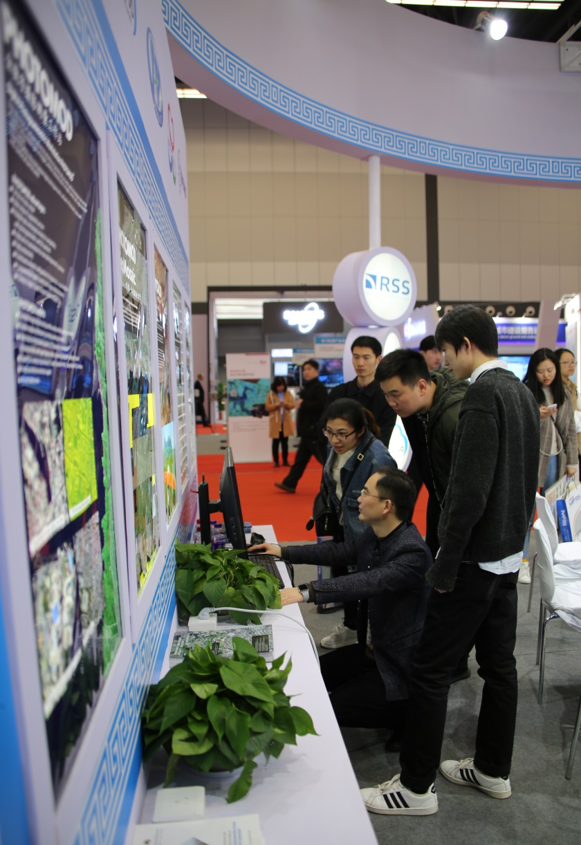
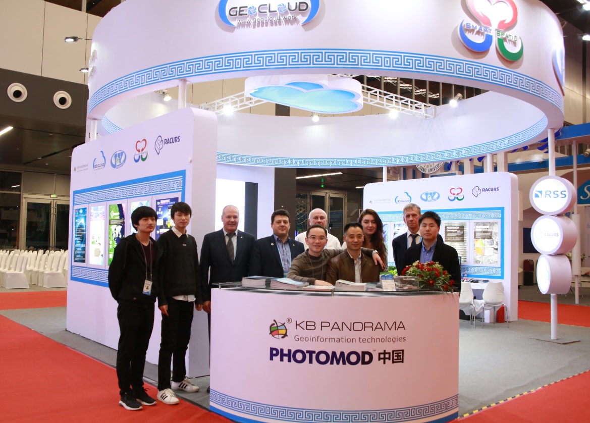
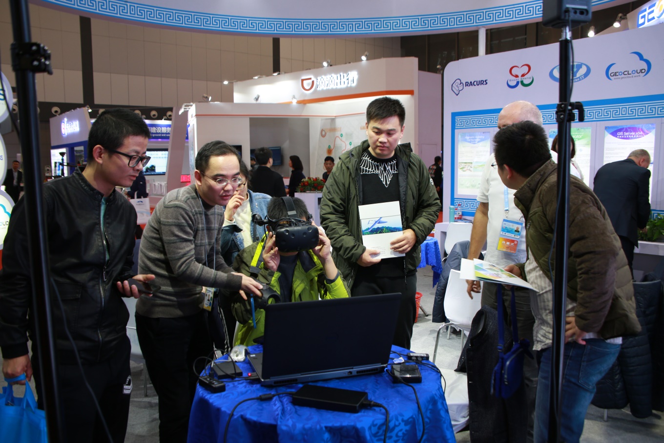
Racurs Company and KB Panorama represented the Russian geoinformation technologies at the joint booth with the Chinese partners SmartSpatio and Jingyao IT. Unfortunately, these were the only Russians among the participants of the Congress. In addition to photogrammetric solutions Racurs Company as a distributor of RSS and SRC Progress provided information about imageries from Russian satellites “Resource-P”, “Canopus-B” and “Aist-2D”. In the frame of the seminar “New Technology Roadshop”, organized by the Congress committee, the head of Racurs technical support department presented New PHOTOMOD 6.4, 3D modeling Conveyor.
During the business meetings the Chinese part demonstrated its interest in expanding cooperation with Russian companies. In particular, the agreement between Racurs and government of Zhejiang Province was signed. It should be noted that China is an active PHOTOMOD user. The total number of users is already more than 100 companies, including governmental cartography-geodesy companies, universities and private business. Racurs regularly holds technical seminars and local conferences in different parts of China. The development of relations with Chinese part is to create cluster solutions for stream processing of remote sensing data on the basis of PHOTOMOD Conveyor software and hardware complex.
Unfortunately, not everyone was able to visit the exhibition, partly because the access to the Congress was limited for security reasons (the visit of the Prime Minister of China was planned) and partly because not large by Chinese standards 6 millionth Deqing doesn’t have enough places in hotels. Nevertheless, the number of visitors was sufficient to talk about the great interest of Chinese companies to geoinformation, including photogrammetric technologies and remote sensing data.
 The second point of the program of the visit of Russian companies to China was one-day seminar “From imagery to digital reality: Digital China & Photogrammetry” in Nanjing, Jiangsu province. Participants traveled there on the-high speed train, covering almost 240 km during 1 hour and 20 min.
The seminar was organized by SmartSpatio and Jingyao IT on the basis of the private cartography company Xingyuejingyao cloud computing sci-tech Ltd and included presentations devoted to photogrammetry technologies PHOTOMOD and geoinformation technologies of KB Panorama. It a pleasant to note, that the name of the seminar is consistent with the name of the annual international conference of our company. As the result of the seminar Xingyuejingyao Company decided to equip the cartography department with the new PHOTOMOD licenses.
Visiting China, as always, left a strong impression on the dynamic development of the economy, rapid construction, high-rise buildings, active introduction of high technologies, friendliness and hospitality of the Chinese people.